HOT from internet !

Showing posts with label Australia. Show all posts

Lake Eyre - Australia

Posted by Ivica Miskovic | Wednesday, December 16, 2009 | | 7 comments »
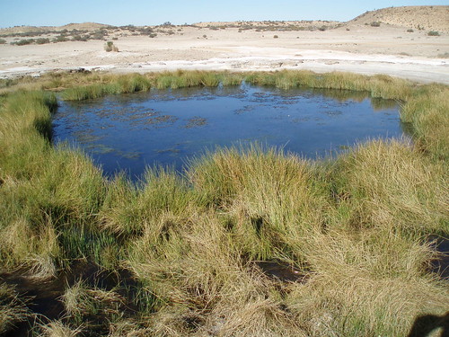
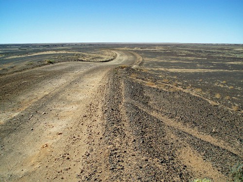
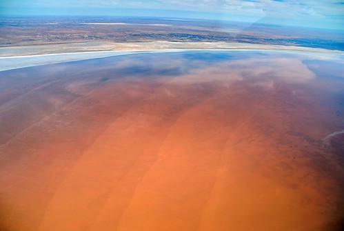
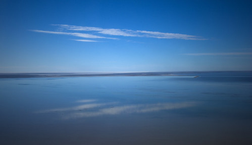
Lake Eyre is the lowest point in Australia, at approximately 15 m (49 ft) (AHD) below sea level, and, on the rare occasions that it fills, it is the largest lake in Australia. It is the focal point of the vast Lake Eyre Basin and is found some 700 km (435 mi) north of Adelaide.

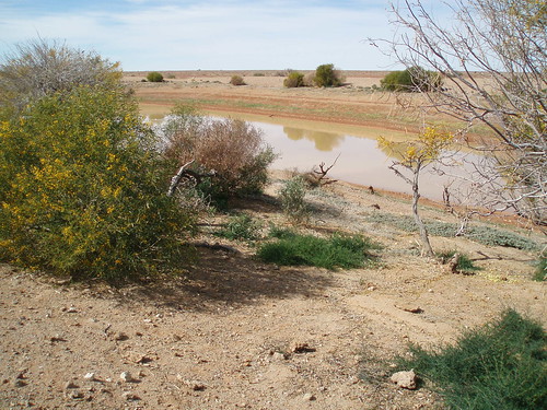
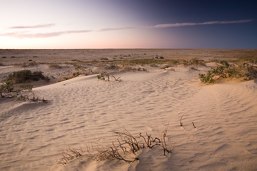
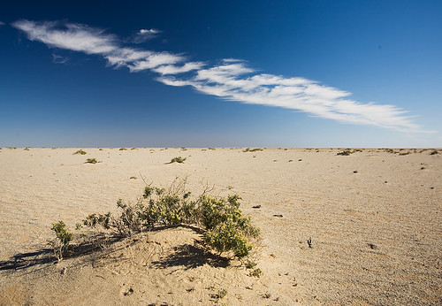
The lake was named after Edward John Eyre who was the first European to sight it in 1840. It is located in the deserts of central Australia, in northern South Australia. The Eyre Basin is a large endorheic system surrounding the lakebed, the lowest part of which is filled with the characteristic salt pan caused by the seasonal expansion and subsequent evaporation of the trapped waters. Even in the dry season there is usually some water remaining in Lake Eyre, normally collecting in a number of smaller sub-lakes on the playa.

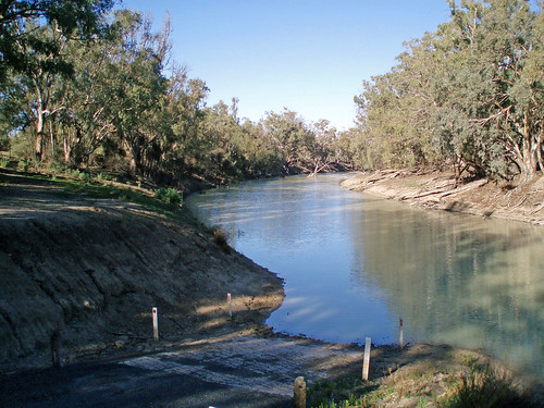
During the rainy season the rivers from the northeast (in outback Queensland) flow towards the lake through the Channel Country. The amount of water from the monsoon determines whether water will reach the lake and if it does, how deep the lake will get. In strong La Niña years the lake can fill. Since 1885 this has occurred in 1886–1887, 1889–1890, 1916–1917, 1950, 1955, 1974–1976 , with the highest flood of 6 m (20 ft) in 1974. Local rain can also fill Lake Eyre to 3–4 m (10–13 ft) as occurred in 1984 and 1989. Wave built shingle terraces on the shore suggest that during the Medieval Warm Period and centuries immediately prior Lake Eyre possibly held permanent water at levels above those of 1974. Torrential rain in January 2007 took about six weeks to reach the lake but put only a small amount of water into it.

When recently flooded the lake is almost fresh and native fresh water fish, including bony bream (Nematolosa erebi), the Lake Eyre Basin sub-species of golden perch (Macquaria ambigua) and various small hardyhead species (Craterocephalus spp.) can survive in it. The salinity increases as the 450 mm (18 in) salt crust dissolves over a period of six months resulting in a massive fish kill. When over 4 m (13 ft) deep the lake is no more salty than the sea and salinity increases as the water evaporates, with saturation occurring at about a 500 mm (20 in) depth. The Lake takes on a "pink" hue when saturated due to the presence of beta-Carotene pigment caused by the algae Dunaliella salina.

Typically a 1.5 m (5 ft) flood occurs every three years, a 4 m (13 ft) flood every decade, and a fill or near fill four times a century. The water in the lake soon evaporates with a minor and medium flood drying by the end of the following summer.

The 2009 Lake Eyre flood peaked at 1.5 m (5 ft) deep in late May which is a quarter of its maximum recorded depth of 6 m (20 ft). 9 km3 (2 cu mi) of water crossed the Queensland–South Australian border with most of it coming from massive floods in the Georgina River. However the greater proportion soaked into the desert or evaporated en route to the lake leaving less than 1 km3 (0.24 cu mi) in the lake which covered an area of 800 km2 (309 sq mi) or 12% of the lake. As the flood did not start filling the lake's deepest point (Belt Bay) until late March little bird life appeared preferring instead to nest in the upper reaches of the Lake Eyre Basin, north of Birdsville, where large lakes appeared in January as a result of monsoonal rain.

credited to wikipedia and flickr users: goody62, simonwaterhouse, gsketch2000, c_and_g, mitshellh53, nic_pepsi

Read More...

Great things to do in Sydney

Posted by Ivica Miskovic | Thursday, July 09, 2009 | | 3 comments »
Taronga Zoo

One of the most spectacular zoological gardens in the world, this is an easy ferry ride from the main Sydney ferry terminal at Circular Quay.

Bondi Beach


Learn to catch the waves at this most famous of Australian shorelines.

Sydney Cricket Ground


The scene of many a famous Ashes battle, the SCG also has behind-the-scenes tours, where cricket lovers can find out more about the game...

... including a face-to-face encounter with a life-size model of the all-time great, Sir Donald Bradman.

Hyde Park Barracks


For an insight into Australia's convict heritage, visit this striking museum off the city's heritage-rich Macquarie Street.

Sydney Harbour Bridge Climb


A magnificent feat of engineering, and now an integral part of the city's skyline, the Sydney Harbour Bridge can now be climbed by the stout of heart.

Voyage on the Tribal Warrior


Visitors can connect with the Sydney area's extensive Aboriginal heritage with a voyage on the Tribal Warrior, where the important sites are pointed out by descendants of Australia's original inhabitants.

Sydney Opera House


Sydney's most famous building can be appreciated from many angles on the outside...

...but don't neglect the opportunity for an insider's view to see and hear all Jørn Utzon's incredible building has to offer.

Sydney pub tour


Ah, the amber nectar. Sydney has a wide network of pubs, with some of the oldest and most interesting congregated around the Rocks area of the city where the original First Fleet landed.

Prawns on the barbie


One of the most popular national pastimes, the barbecue is an essential part of any self-respecting Australian's culinary armoury. Visitors can learn how it's done at the famous Sydney Fish Market.

The Blue Mountains


Just a short train ride from Sydney, the Blue Mountains give a spectacular taste of Australia's raw, unforgiving Outback.

credited to telegraph.co.uk

Read More...

Olga's mountains range - Australia

Posted by Ivica Miskovic | Friday, April 03, 2009 | | 0 comments »
Kata Tjuta, sometimes written Kata Tjuta, and also known as Mount Olga (or colloquially as The Olgas), are a group of large domed rock formations located about 365 km southwest of Alice Springs, in the southern part of the Northern Territory, central Australia. Uluru, 25 km to the east and Kata Tjuta form the two major landmarks within the Uluru-Kata Tjuta National Park. The 36 domes, covering an area of 21.68 km², are composed of conglomerate, a sedimentary rock consisting of cobbles and boulders of varying rock types including granite and basalt, cemented by a matrix of sandstone. The highest point, Mount Olga, is 1066 m above sea level, or approximately 546 m above the surrounding plain (203 m higher than Uluru). Kata Tjuta is located at the eastern end of the Docker River Road.

The Pitjantjajara name Kata Tjuta means 'many heads'. The site is as sacred to the Indigenous people as Uluru.

The alternative name, The Olgas, comes from the tallest peak, Mt Olga. At the behest of Baron Ferdinand von Mueller, Mt Olga was named in 1872 by Ernest Giles, in honour of Queen Olga of Württemberg. She and her husband King Karl had marked their 25th wedding anniversary the previous year by, amongst other things, naming Mueller a Freiherr (baron), making him Ferdinand von Mueller; this was his way of repaying the compliment.

On 15 December 1993, a dual naming policy was adopted that allowed official names consisting of both the traditional Aboriginal name and the English name. As a result, Mount Olga was renamed Mount Olga / Kata Tjuta. On 6 November 2002, following a request from the regional Tourism Association, the order of the dual names were officially reversed to Kata Tjuta / Mount Olga.

There are many Pitjantjatjara Dreamtime legends associated with this place and indeed everything in the vicinity including, of course, Uluru. A number of legends surround the great snake Wanambi who is said to live on the summit of Mount Olga and only comes down during the dry season.

Many ceremonies were, and are still carried out here, particularly at night. One of these former ceremonies included a type of public punishment that in extreme cases included death.

credited to wikipedia and flickr users: mtchm, david_stephensen, dmmaus, rob_inh00d, digitalreflections, angusbull, corwinsl, stefanvilliger, subiyurek, island_home, sherwood_harrington, buraian, stuart_phoenix, maderman

Read More...

Uluru (Ayers Rock) - Australia

Posted by Ivica Miskovic | Thursday, March 05, 2009 | | 1 comments »
Uluru, also referred to as Ayers Rock, is a large sandstone rock formation in the southern part of the Northern Territory, central Australia. It lies 335 km (208 mi) south west of the nearest large town, Alice Springs; 450 km (280 mi) by road. Kata Tjuta (The Olgas) and Uluru are the two major features of the Uluru - Kata Tjuta National Park. Uluru is sacred to the Pitjantjatjara and Yankunytjatjara, the Aboriginal people of the area. It has many springs, waterholes, rock caves and ancient paintings. Uluru is listed as a World Heritage Site.

Uluru is one of Australia's most recognisable natural icons. The world-renowned sandstone formation stands 348 m (1,142 ft) high (863 m/2,831 ft above sea level) with most of its bulk below the ground, and measures 9.4 km (5.8 mi) in circumference. Both Uluru and Kata Tjuta have great cultural significance for the Aṉangu Traditional landowners, who lead walking tours to inform visitors about the local flora and fauna, bush foods and the Aboriginal dreamtime stories of the area.

Uluru is notable for appearing to change colour as the different light strikes it at different times of the day and year, with sunset a particularly remarkable sight when it briefly glows red. Although rainfall is uncommon in this semiarid area, during wet periods the rock acquires a silvery-grey colour, with streaks of black algae forming on the areas that serve as channels for water flow.

Kata Tjuta, also called Mount Olga or The Olgas owing to its peculiar formation, is another rock formation about 25 km (16 mi) from Uluru. Special viewing areas with road access and parking have been constructed to give tourists the best views of both sites at dawn and dusk.

credited to wikipedia and flickr users: andrew, peternijenhuis, jonathansabin, yewco, markeveleigh, vtveen, the_guenni, pedroqtc, vtveen

Read More...