HOT from internet !

Showing posts with label Ghost town's. Show all posts

Ghost place - Red Forest near Pripyat

Posted by Ivica Miskovic | Wednesday, December 02, 2009 | , | 0 comments »
The Red Forest, formerly the Worm Wood Forest, refers to the trees in the 10 km² surrounding the Chernobyl Nuclear Power Plant. The name 'Red Forest' comes from the ginger-brown colour of the pine trees after they died following the absorption of high levels of radiation from the Chernobyl accident on April 26, 1986. In the post-disaster cleanup operations, the Red Forest was bulldozed and buried in 'waste graveyards'. The site of the Red Forest remains one of the most contaminated areas in the world today.

The Red Forest is located in the zone of alienation; this area received the highest doses of radiation from the Chernobyl accident and the resulting clouds of smoke and dust, heavily polluted with radiation. The trees died from this radiation. The explosion and fire at the Chernobyl No. 4 reactor contaminated the soil, water and atmosphere with the radiation equivalent to 20 of the atomic bombings of Hiroshima and Nagasaki.

In the post-disaster cleanup operations, a majority of the pine trees were bulldozed and buried in trenches by the "liquidators". The trenches were then covered with a thick carpet of sand and planted with pine saplings. Many fear that as the trees decay radiation will leach into the ground water. People have evacuated the contaminated zone around the Red Forest.

As humans were evacuated from the area in 1986, animals moved in despite the radiation. The flora and fauna of the Red Forest have been dramatically affected by the radioactive contamination that followed the accident. It seems that the biodiversity of the Red Forest has increased in the years following the disaster. There are reports of higher numbers of mutations in some of the plants in the area, leading to unsubstantiated tales of a "forest of wonders" containing many strangely mutated plants. Specifically, some trees have weirdly twisted branches that do not reach for the sky.

In the years after the disaster, some plants have displayed gigantism, in which the shape of the plants features remain normal, but its size becomes much larger than average. Gigantism and other plant abnormalities of the Red Forest can be found in the most radioactive parts of the zone of alienation.

The site of the Red Forest remains one of the most contaminated areas in the world. However, it has proved to be an astonishingly fertile habitat for many endangered species. The evacuation of the area surrounding the nuclear reactor has created a lush and unique wildlife refuge. In the 1996 BBC Horizon documentary "Inside Chernobyl's Sarcophagus", birds are seen flying in and out of large holes in the structure of the former nuclear reactor. The long-term impact of the fallout on the flora and fauna of the region is not fully known, as plants and animals have significantly different and varying radiologic tolerance. Some birds are reported with stunted tail feathers (which interferes with breeding). Storks, wolves, beavers, and eagles have been reported in the area. and joint International Atomic Energy Agency/WHO/UNDP press release Chernobyl: The True Scale of the Accident, International Atomic Energy Agency/World Health Organization/United Nations Development Programme, September 5, 2005.

Today

Today, radiation levels in the Red Forest can be as high as one röntgen per hour, but levels of ten milliröntgens per hour are more common. More than 90% of the radioactivity of the Red Forest is concentrated in the soil.

Scientists are planning to use the radioactive ghost town and surrounding area as a unique laboratory for modeling the dispersal of radionuclides by the detonation of a dirty bomb or an attack with chemical or biological agents. The area offers an unparalleled opportunity to fully understand the passage of radioactive debris through an urban and rural area.

The nature of the area seems to have not only survived, but flourished due to significant reduction of human impact. The zone has become a "Radiological Reserve", a classic example of an involuntary park. There were thought to be cases of mutant deformity in animals of the Red Forest, but none have been proven, except partial albinism in swallows. Currently, there is concern about contamination of the soil with Strontium-90 and Caesium-137, which have half-lives of about 30 years. The highest levels of Caesium-137 are found in the surface layers of the soil where they are absorbed by plants, and insects living there today. Some scientists fear that radioactivity will affect the land for the next several generations.

credited to wikipedia

Read More...

A town that's been on fire since 1962

Posted by Ivica Miskovic | Monday, November 02, 2009 | , | 0 comments »

Centralia is a borough and ghost town in Columbia County, Pennsylvania, United States. Its population has dwindled from over 1,000 residents in 1981 to 12 in 2005 and 9 in 2007, as a result of a mine fire burning beneath the borough since 1962. Centralia is now the least-populous municipality in Pennsylvania, with four fewer residents than the borough of S.N.P.J.

Centralia is part of the Bloomsburg–Berwick Micropolitan Statistical Area.

Johnathan Faust opened Bull's Head Tavern in 1841 in what was then Roaring Creek Township. In 1854, Alexander W. Rea, a civil and mining engineer for the Locust Mountain Coal and Iron Company, moved to the site and laid out streets and lots for development. The town was known as Centreville until 1865. There was another Centreville in Schuylkill County, however, and the Post Office would not allow a second one, so Rea named his village Centralia.

Centralia was incorporated as a borough in 1866. The anthracite coal industry was the principal employer in the community. Coal mining continued in Centralia until the 1960s, when most of the companies went out of business. Bootleg mining continued until 1982. Strip and open-pit mining is still active in the area, and there is an underground mine employing about 40 employees three miles to the west.

The borough was also a hotbed of Molly Maguires activity during the 1860s and 1870s. The borough's founder, Alexander Rea, was one of the victims of the secret order when he was murdered just outside of the borough on October 17, 1868. Three individuals were convicted of the crime and hanged in the county seat of Bloomsburg, Pennsylvania on March 25, 1878. Several other murders and arsons also occurred during this period.

The borough was served by two railroads, the Philadelphia and Reading and the Lehigh Valley, with the Lehigh Valley being the principal carrier. Rail service ended in 1966. The borough operated its own school district with elementary schools and a high school within its precincts. There were also two Catholic parochial schools in the borough. The borough once had seven churches, five hotels, twenty-seven saloons, two theatres, a bank, post office, and fourteen general and grocery stores. During most of the borough's history, when coal mining activity was being conducted, the town had a population in excess of 2,000 residents. Another 500 to 600 residents lived in unincorporated areas immediately adjacent to Centralia.

It is not known for certain how the fire that made Centralia essentially unlivable was ignited. One theory asserts that in May 1962, Centralia Borough Council hired five members of the volunteer fire company to clean up the town landfill, located in an abandoned strip mine pit next to the Odd Fellows Cemetery. This had been done prior to Memorial Day in previous years, when the landfill was in a different location. The firefighters, as they had in the past, set the dump on fire, and let it burn for a time. Unlike in previous years, however, the fire was not extinguished.

Other evidence supports this theory, as stated in Joan Quigley's 2007 missive, such as the fact that one of two trash haulers (Curly Stasulevich or Sam Devine) dumped hot ash and/or coal discard from coal burners into the open trash pit. The borough, by law, was responsible for installing a fire-resistant clay barrier between each layer but had fallen behind. This action allowed the hot coals to penetrate the vein of coal underneath the pit and subsequent subterranean fire. Quigley cites "interviews with volunteer firemen, the former fire chief, borough officials, and several eyewitnesses, as well as contemporaneous borough council minutes" as her sources for this explanation of the fire. Another theory of note is the Bast Theory. It states that the fire was burning long before the alleged trash dump fire. However, due to overwhelmingly contrary evidence, few hold this position and give it little credibility.

The fire remained burning underground and spread through a hole in the rock pit into the abandoned coal mines beneath Centralia. Attempts to extinguish the fire were unsuccessful and it continued to burn throughout the 1960s and 1970s. Adverse health effects were reported by several people due to the byproducts of the fire, carbon monoxide and carbon dioxide and lack of healthy oxygen levels.

In 1979, locals became aware of the scale of the problem when a gas-station owner and then mayor, John Coddington, inserted a stick into one of his underground tanks to check the fuel level. When he withdrew it, it seemed hot, so he lowered a thermometer down on a string and was shocked to discover that the temperature of the gasoline in the tank was 172 °F (77.8 °C). Statewide attention to the fire began to increase, culminating in 1981 when 12-year-old resident Todd Domboski fell into a subsidence four feet wide by 150 feet (46 m) deep that suddenly opened beneath his feet in a backyard.

In 1984, Congress allocated more than $42 million for relocation efforts. Most of the residents accepted buyout offers and moved to the nearby communities of Mount Carmel and Ashland. A few families opted to stay despite warnings from state officials.

In 1992, Pennsylvania claimed eminent domain on all properties in the borough, condemning all the buildings within. A subsequent legal effort by residents to have the decision reversed failed. In 2002, the United States Postal Service revoked Centralia's ZIP Code, 17927.

Today

Very few homes remain standing in Centralia; most of the abandoned buildings have been demolished by humans or nature. At a casual glance the area now appears to be a field with many paved streets running through it. Some areas are being filled with new-growth forest. Most of Centralia's roads and sidewalks are overgrown with brush, although some areas appear to be mowed. The remaining church in the borough, St. Mary's, holds weekly services on Sunday and is unaffected by the fire. The town's four cemeteries are maintained in good condition and now have a far greater population than the town, including one on the hilltop that has smoke rising around and out of it.

The only indications of the fire, which underlies some 400 acres (1.6 km²), spreading along four fronts, are low round metal steam vents in the south of the borough, and several signs warning of underground fire, unstable ground, and carbon monoxide. Additional smoke and steam can be seen coming from an abandoned portion of Pennsylvania Route 61, the area just behind the hilltop cemetery, and other cracks in the ground scattered about the area. Route 61 was repaired several times until its final closing. The current route was a detour around the damaged portion during the repairs and became a permanent route in the mid-1990s; mounds of dirt were placed at both ends of the former route, effectively blocking the road. Pedestrian traffic is still possible due to a small opening about two feet wide at the north side of the road, but this is muddy and not accessible to the disabled. The underground fire is still burning and will continue to do so for a predicted 250 more years.

Prior to its demolition in September 2007, the last remaining house on Locust Avenue was notable for the five chimney-like support buttresses along each of two opposite sides of the house, where the house was previously supported by a row of adjacent buildings before it was demolished. Another house with similar buttresses is visible from the northern side of the cemetery, just north of the burning, partially subsumed hillside.

The Commonwealth of Pennsylvania did not renew the relocation contract at the end of 2005, and the fate of the remaining residents is uncertain.

It is expected that many former residents will return in 2016 to open a time capsule buried in 1966 next to the veterans' memorial.

credited to wikipedia

Read More...

Ghost town - Hashima Island, Gunkanjima, Japan

Posted by Ivica Miskovic | Monday, January 28, 2008 | | 5 comments »
Hashima Island (meaning "Border Island"), commonly called Gunkanjima (meaning "Battleship Island") is one among 505 uninhabited islands in the Nagasaki Prefecture about 15 kilometers from Nagasaki itself. The island was populated from 1887 to 1974 as a coal mining facility. The island's most notable features are the abandoned concrete buildings and the sea wall surrounding it.

"Battleship Island" is an English translation of the Japanese nickname for Hashima Island, Gunkanjima. The island's nickname came from its apparent resemblance to a battleship, or gunkan (jima is a mutation of shima) due to its high sea-walls. It also is known as the Ghost Island. It is known for its coal mines and their operation during the industrialization of Japan. Mitsubishi bought the island in 1890 and began the project, the aim of which was retrieving coal from the bottom of the sea. They built Japan's first large concrete building, a block of apartments in 1916 to accommodate their burgeoning ranks of workers, and to protect against typhoon destruction.

In 1959, its population density was 835 people per hectare (83,500 people/km^2) for the whole island, or 1,391 per hectare (139,100 people/km^2) for the residential district, one of the highest population density ever recorded worldwide. As petroleum replaced coal in Japan in the 1960s, coal mines began shutting down all over the country, and Hashima's mines were no exception. Mitsubishi officially announced the closing of the mine in 1974, and today it is empty and bare, which is why it's called the Ghost Island. Travel to Hashima is currently prohibited.

credited to flickr users: origamikid, stuartfrisby, christophklemmt, beat8682 and elbauldejosete.files.wordpress.com, wikimedia.org, hipogrifos.files.wordpress.com

Read More...

Ghost town - Kadykchan, Russia

Posted by Ivica Miskovic | Friday, January 25, 2008 | | 0 comments »
Kadykchan, The City of Broken Dreams

No, this isn’t Chernobyl and there isn’t any dangerous radioactive background or toxic pollution. You can even live in this town… but there is no reason for. This place has become absolutely useless after the collapse of the USSR, like many other Soviet industrial settlements.

images credited to shatoon.ru, englishrussia.com, livejournal.com, alltrains.ru, webshots.com

Read More...

Ghost town - Bodie, California

Posted by Ivica Miskovic | Saturday, December 29, 2007 | | 8 comments »
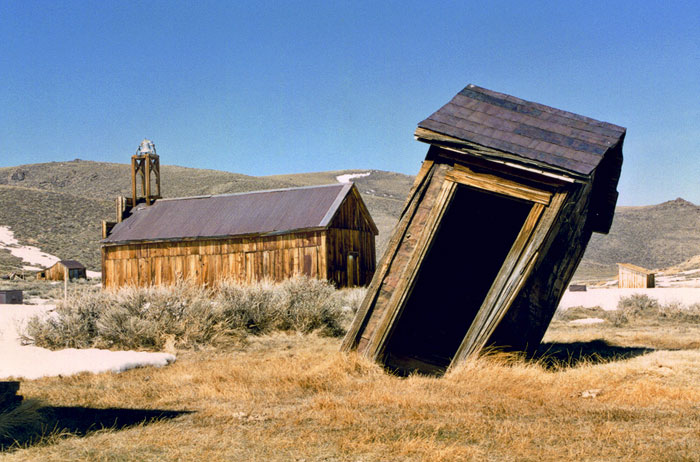
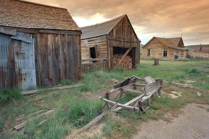
Bodie ghost town on the eastern slope of the Sierra Nevada mountain range in Mono County, California, United States, about 75 miles (120 km) southeast of Lake Tahoe, at an elevation of 8369 feet (2550 m).

Gold was discovered in 1859 by prospector Wakeman S. Bodey, who the town was named after. Bodey died in November making a supply trip and becoming stranded in a blizzard.

In 1876, the Standard Company discovered a profitable deposit of gold transformed Bodie from an isolated mining camp of few prospectors to a boomtown.

Bodie was famous for its lawlessness. At its peak in 1880, it had 60 saloons. Murders, brawls, and stagecoach holdups were constant occurrences. Legend has it that a little girl, upon finding out that her family was moving there,prayed one night, "Goodbye God, I am going to Bodie."

Gold bullion from the town's nine stamp mills was shipped to Carson City, Nevada accompanied by armed guards. Once the bullion reached Carson City, it was sent by rail to the San Francisco mint.

In 1893 the Standard Company built its own hydroelectric plant, located approximately 13 miles away on Green Creek, above Bridgeport, California. The plant developed a maximum of 130 horsepower and 6,600 volts alternating current to power the company's 20-stamp mill. This pioneering installation was one of the first times an electric motor was operated over long-distance power lines.

Bodie's Chinatown, had several hundred Chinese residents at one point. The Chinese workers earned their incomes mainly from selling vegetables, operating laundries, and cutting, hauling, and selling firewood. Winter temperatures in Bodie would often fall well below zero, and winds reaching nearly 100 miles per hour would sweep across the high open valley. Large amounts of firewood were needed to keep residents warm through the long winters. Many ill-prepared towns folk perished during the extremely harsh winter of 1878-1879.

Today Bodie is an authentic, intact ghost town. Bodie is currently a State Historic Park. Visitors walk the deserted streets of a town that once had a population between 7,000 and 8,000 people. Interiors remain as they were left and in some cases stocked with goods. The remains of Bodie are being preserved in a state of arrested decay...


credited to legendsofamerica.com, ghosttowngallery.com, explorehistoricalif.com, futurballa.com, davestravelcorner.com, jstottphotography.com, photo.net

Read More...